The world's great rivers, and why size does not decide where cities grow
Rivers are measured in two ways, and neither one predicts where civilization appears. Length measures how far the river travels. Flow measures how much water passes a point each second. The list below is ordered by length, because length is the number most people know. Each entry also gives the flow and states whether boats can use the river, because the difference between those three is the point of the list. The longest rivers and the strongest rivers are often not the ones that built cities. Cities were built where water met farmland, a mild climate, and a trade route. The river that carried the first civilization, the Euphrates in Sumer, is too short to appear on this list at all.
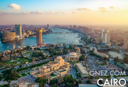
- Nile, 6,650 km, Egypt and Sudan and East Africa. The longest river on Earth, and one of the weakest by flow, at about 3,000 cubic metres per second. Most of its water evaporates crossing the Sahara. It still supported ancient Egypt and still supplies Cairo today. A river that passes through farmland matters more than a river that carries a large volume of water.
- Amazon, 6,400 km, Brazil and Peru and Colombia. By far the strongest river on Earth, moving 209,000 cubic metres per second, and more by some measurements. That is roughly 15 to 18 percent of all the river water that reaches the oceans. Its basin is rainforest, and it holds almost no large cities. It has the most water and the fewest cities.
- Yangtze, 6,300 km, China. Long and strong, at about 30,000 cubic metres per second, and boats can travel far inland along it. Shanghai sits at its mouth. It is one of the great rivers of world history.
- Mississippi and Missouri, 6,275 km, United States. This system built inland trade in the United States. It offers thousands of kilometres of water that boats can use, and all of it drains to a single outlet at the sea. Its value comes from being usable by boats, not from its size.
- Yenisei, 5,540 km, Russia and Mongolia. One of the strongest rivers on Earth, but it flows north through cold and empty Siberia. It carries a large amount of water past very few people.
- Yellow River, 5,464 km, China. Chinese civilization started here, and the Shang dynasty rose on this river. The silt it deposits is rich, and it fed early farming despite frequent floods.
- Ob and Irtysh, 5,410 km, Russia and Kazakhstan and China. A long river system in Siberia, with few people along it, and cold for most of the year. Length on its own builds nothing without a warm climate.
- Paraná, 4,880 km, Brazil and Argentina and Paraguay. It flows into the Río de la Plata, where Buenos Aires stands. It is a modern trade river rather than the site of an ancient civilization.
- Congo, 4,700 km, Democratic Republic of the Congo and Central Africa. The second strongest river on Earth, at about 41,000 cubic metres per second on average. Rapids and waterfalls stop boats from travelling along it. Inga Falls, on this river, is the most powerful waterfall on Earth by volume of water, and no boat can pass it. This river carries an enormous amount of water that trade cannot use. It is the clearest case that a strong flow on its own is not enough.
- Amur, 4,444 km, Russia and China. The long border river of northeast Asia. It is cold, and few people live along most of its length.
- Lena, 4,400 km, Russia. A remote Arctic river. It carries a large amount of water, it is frozen for most of the year, and there are almost no cities on it.
- Mekong, 4,350 km, China and Laos and Thailand and Cambodia and Vietnam. It supplies the rice-growing societies of Southeast Asia. Its delta is warm, wet, and fertile, and it supports very large populations.
- Mackenzie, 4,240 km, Canada. Long and cold, draining into the Arctic. It is one of the emptiest of the great rivers.
- Niger, 4,200 km, Guinea and Mali and Niger and Benin and Nigeria. It supported the medieval empires of Mali and Songhai, and today it flows through Nigeria, the most populous country in Africa.
- Indus, 3,610 km, Pakistan and India and China. The river of the Indus Valley, one of the six places where civilization started on its own.
Compare the top of the list with the bottom. The five longest rivers include the Amazon, the Yenisei, and the Ob, and none of the three produced a major civilization. Rainforest and frozen Siberia cancel out even the strongest flow. The rivers that shaped history sit low on the list or do not appear on it at all. The Yellow River is near the bottom. The Indus only just qualifies. The Euphrates is 2,800 km long, shorter than every river listed above, and it never appears, yet it carried Sumer, the first civilization on Earth. Size does not decide where cities grow. Water that meets farmland, a warm climate, and a trade route decides. That is the same rule as before, and it is visible across the map of the world's rivers.
The countries these rivers cross
These are the countries the fifteen rivers above flow through. Each card below opens that country's page on this site.