Uganda is an East African nation expanding agriculture exports, renewable energy investments, wildlife conservation tourism, and regional infrastructure development.

Uganda
Uganda is an East African nation expanding agriculture exports, renewable energy investments, wildlife conservation tourism, and regional infrastructure development.


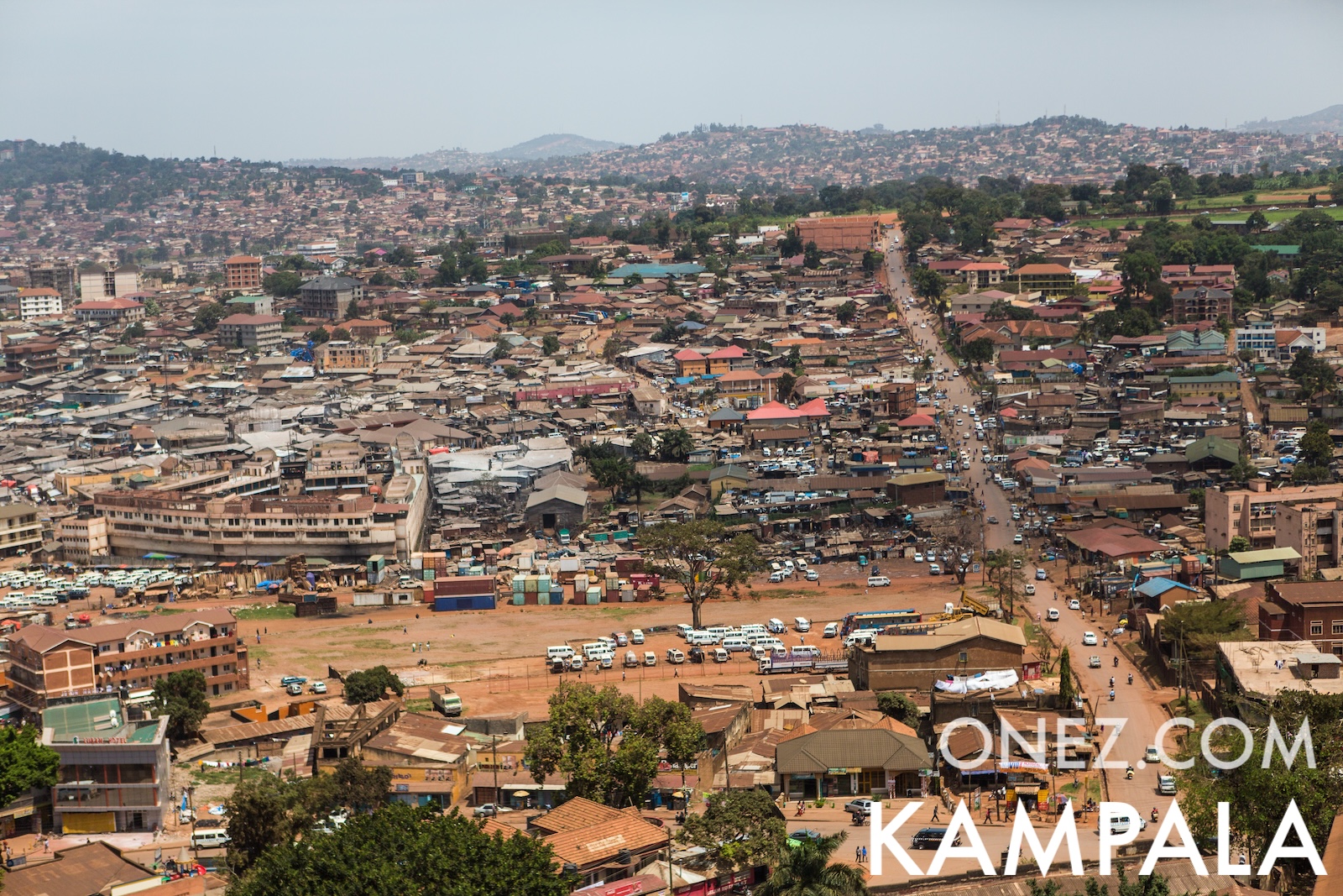
The capital city of Uganda is Kampala, capital city of Uganda.
Word: Gorilla
Meaning: mountain ape
Uganda is a Country on the Sub-Saharan Africa located in the Eastern Africa sub-region in the continent of Africa.
Capital City: Kampala, capital city of Uganda
Population: 51,384,894 (UN)
Area: 236,040 km² / 146,668 sq mi
People from Uganda are called: Ugandans
Latitude: 1.973° N
Longitude: 32.949° E
Geographical Subregion: Eastern Africa
Intermediary Region: Sub-Saharan Africa
Continental Region: Africa
tropical; generally rainy with two dry seasons (December to February, June to August); semiarid in northeast
EF EPI Position: 40 (EF EPI)
EF EPI Score: 535 (EF EPI)
EF EPI Proficiency: Moderate Proficiency (EF EPI)
Global Peace Index Rank: 130 (GPI)
Global Peace Index Score: 2.42 (GPI)
HDI Rank: 157 (UNDP)
HDI Value: 0.582
Mean Years of Schooling: 6.3
Expected Years of Schooling: 11.6
Life Expectancy at Birth: 68.3 Years
Most Predominant: Protestant Anglican, Pentecostal/Born Again/Evangelical, Seventh Day Adventist, Baptist
Second Most Predominant: Catholic
Legal Status: Illegal (ILGA)
Legal Mechanism: N/A
Death Penalty: No
Maximum Prison Sentence: Life
Physical Punishment: Other
TLD: .ug
Calling Code: +256
MapGeo Name: Uganda
MapGeo Code: UG