
The Bahamas spreads some 700 islands across the Atlantic, only around thirty of them inhabited. Dean's Blue Hole is among the deepest known underwater sinkholes.
The Bahamas
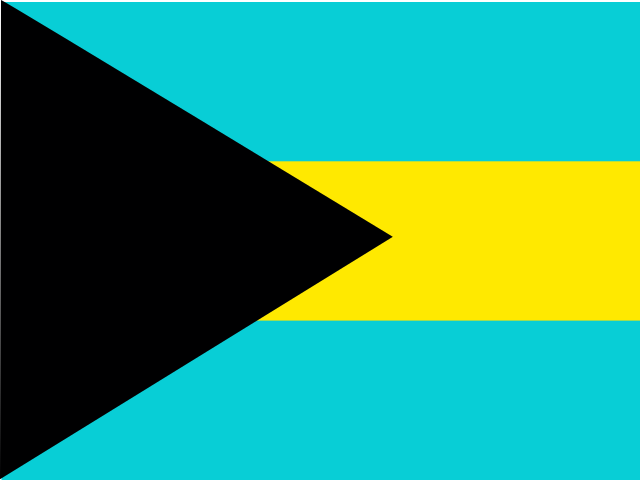
The Bahamas Flag
The Bahamas Armorial

The Bahamas Map
Easy learning about The Bahamas
The capital city of The Bahamas is Nassau, capital city of The Bahamas.
Word: Cays
Meaning: small islands
Administrative Divisions
29 districts and 1 division.
Districts:
- Acklins
- Berry Islands
- Bimini
- Black Point
- Cat Island
- Central Abaco
- Central Andros
- Central Eleuthera
- Crooked Island
- East Grand Bahama
- Exuma
- Freeport
- Harbour Island
- Inagua
- Long Island
- Mangrove Cay
- Mayaguana
- Moore's Island
- North Abaco
- North Andros
- North Eleuthera
- Ragged Island
- Rum Cay
- San Salvador Island
- South Abaco
- South Andros
- South Eleuthera
- Spanish Wells
- West Grand Bahama
Division:
- BS-X01
Administrative divisions of The Bahamas map
The Bahamas is a Country of Lucayan Archipelago on the Latin America and the Caribbean located in the Caribbean sub-region in the continent of Americas, member of CARICOM.
0150 km (93 mi)300 km (186 mi)450 km (280 mi)600 km (373 mi)
Height
-5 m (-16 ft), 5 m (16 ft), 10 m (33 ft), 25 m (82 ft), 40 m (131 ft), 50 m (164 ft), 75 m (246 ft), 100 m (328 ft), Max altitude 101 m (331 ft)Sea depth
0 m (0 ft), 150 m (492 ft), 600 m (1970 ft), 1800 m (5910 ft), 3200 m (10500 ft), deeper than 5200 m (17060 ft)Height from west to east in The Bahamas
Height from south to north in The Bahamas
1North Atlantic Ocean0 m
Population of The Bahamas, 1960–2025
The World Bank: Population, total (SP.POP.TOTL): United Nations Population Division, national statistical offices
Basic Information
Capital City: Nassau, capital city of The Bahamas
Population: 403,033 (World Bank)
Area: 13,878 km² / 5,358 sq mi
People from The Bahamas are called: Bahamians
Geography
Latitude: 26.402° N
Longitude: 77.147° W
Geographical Subregion: Caribbean
Intermediary Region: Latin America and the Caribbean
Continental Region: Americas
Highest Elevation Point: Mount Alvernia (63 m)
Lowest point: Atlantic Ocean (0 m)
Climate
tropical marine; moderated by warm waters of Gulf Stream
Human Development
HDI Rank: 66 (UNDP)
HDI Value: 0.82
Mean Years of Schooling: 12.8
Expected Years of Schooling: 11.9
Life Expectancy at Birth: 74.6 Years
Religion
Most Predominant: Protestant includes Baptist, Anglican, PentecostalSeventh Day Adventist, Methodist, Church of God, Brethren, other Protestant
Second Most Predominant: Catholic
LGBTI Rights
Legal Status: Legal (ILGA)
Legal Mechanism: Legislative
Death Penalty: No
Maximum Prison Sentence: No
Physical Punishment: No
International Memberships
CARICOM - since 1983
Technical Information
Official website: bahamas.gov.bs
TLD: .bs
Calling Code: +-241
MapGeo Name: Bahamas
MapGeo Code: BS