Serbia
Serbia Flag

Serbia Armorial

Serbia is a Balkan nation growing through technology outsourcing, automotive manufacturing, renewable energy projects, and strategic infrastructure investments.
Serbia is a Country located in the Southern Europe sub-region of the Europe continent.
Easy learning about Serbia
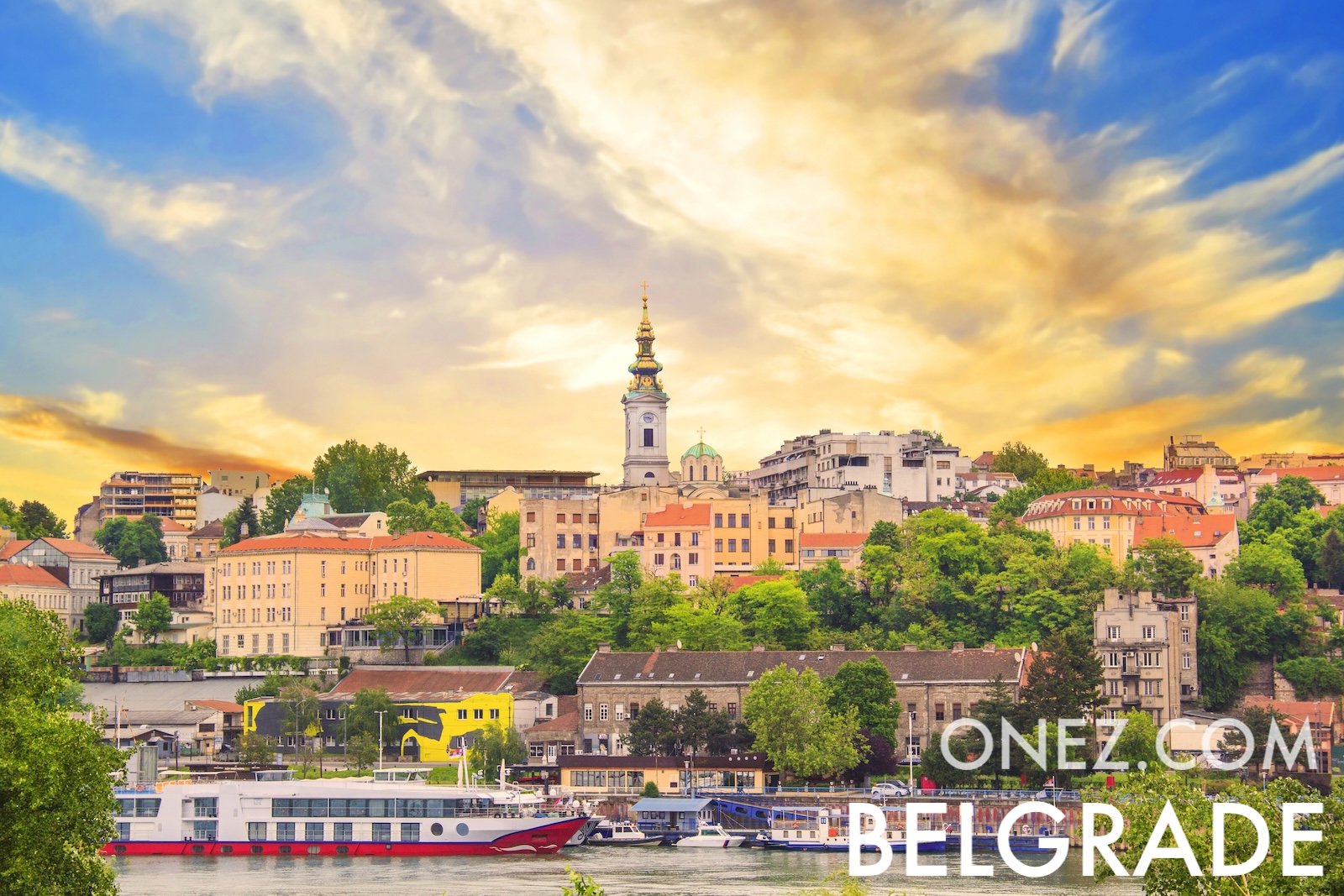
The capital city of Serbia is Belgrade.
Word: Rakija
Meaning: plum spirit
Basic Information
Capital City: Belgrade
Population: 6,773,201 (UN)
Area: 88,361 km² / 54,905 sq mi
People are called: Serbs, Serbians
Type: Country
Administrative Divisions
117 municipalities (opstine) and 28 cities (gradovi)
municipalities
- Ada*
- Aleksandrovac
- Aleksinac
- Alibunar*
- Apatin*
- Arandelovac
- Arilje
- Babusnica
- Bac*
- Backa Palanka*
- Backa Topola*
- Backi Petrovac*
- Bajina Basta
- Batocina
- Becej*
- Bela Crkva*
- Bela Palanka
- Beocin*
- Blace
- Bogatic
- Bojnik
- Boljevac
- Bosilegrad
- Brus
- Bujanovac
- Cajetina
- Cicevac
- Coka*
- Crna Trava
- Cuprija
- Despotovac
- Dimitrov
- Doljevac
- Gadzin Han
- Golubac
- Gornji Milanovac
- Indija*
- Irig*
- Ivanjica
- Kanjiza*
- Kladovo
- Knic
- Knjazevac
- Koceljeva
- Kosjeric
- Kovacica*
- Kovin*
- Krupanj
- Kucevo
- Kula*
- Kursumlija
- Lajkovac
- Lapovo
- Lebane
- Ljig
- Ljubovija
- Lucani
- Majdanpek
- Mali Idos*
- Mali Zvornik
- Malo Crnice
- Medveda
- Merosina
- Mionica
- Negotin
- Nova Crnja*
- Nova Varos
- Novi Becej*
- Novi Knezevac*
- Odzaci*
- Opovo*
- Osecina
- Paracin
- Pecinci*
- Petrovac na Mlavi
- Plandiste*
- Pozega
- Presevo
- Priboj
- Prijepolje
- Raca
- Raska
- Razanj
- Rekovac
- Ruma*
- Secanj*
- Senta*
- Sid*
- Sjenica
- Smederevska Palanka
- Sokobanja
- Srbobran*
- Sremski Karlovci*
- Stara Pazova*
- Surdulica
- Svilajnac
- Svrljig
- Temerin*
- Titel*
- Topola
- Trgoviste
- Trstenik
- Tutin
- Ub
- Varvarin
- Velika Plana
- Veliko Gradiste
- Vladicin Han
- Vladimirci
- Vlasotince
- Vrbas*
- Vrnjacka Banja
- Zabalj*
- Zabari
- Zagubica
- Zitiste*
- Zitorada
cities
- Beograd (Belgrade)
- Bor
- Cacak
- Jagodina
- Kikinda*
- Kragujevac
- Kraljevo
- Krusevac
- Leskovac
- Loznica
- Nis
- Novi Pazar
- Novi Sad*
- Pancevo*
- Pirot
- Pozarevac
- Prokuplje
- Sabac
- Smederevo
- Sombor*
- Sremska Mitrovica*
- Subotica*
- Uzice
- Valjevo
- Vranje
- Vrsac*
- Zajecar
- Zrenjanin*
Geography
Latitude: 44° 00' N
Longitude: 21° 00' E
Geographical Subregion: Southern Europe
Continental Region: Europe
Borders
- Albania — Land border
- Hungary — Land border
- North Macedonia — Land border
- Romania — Land border
- Croatia — Land border
- Bosnia and Herzegovina — Land border
- Bulgaria — Land border
- Montenegro — Land border
- Kosovo — Land border
Climate
in the north, continental climate (cold winters and hot, humid summers with well-distributed rainfall); in other parts, continental and Mediterranean climate (relatively cold winters with heavy snowfall and hot, dry summers and autumns)
Global Indices
EF EPI Position: 24 (EF EPI)
EF EPI Score: 568 (EF EPI)
EF EPI Proficiency: High Proficiency (EF EPI)
Global Peace Index Rank: 54 (GPI)
Global Peace Index Score: 1.930 (GPI)
Human Development
HDI Rank: 62 (UNDP)
HDI Value: 0.833
Mean Years of Schooling: 11,6
Expected Years of Schooling: 15,0
Life Expectancy at Birth: 76,8 Years
Religion
Most Predominant: Orthodox
Second Most Predominant: Catholic
Technical Information
TLD: .rs
Calling Code: +381
MapGeo Name: Serbia
MapGeo Code: RS