
Antigua and Barbuda is a two-island state in the eastern Caribbean. English Harbour holds Nelson's Dockyard, the only Georgian naval dockyard in the world still in working use.
Antigua and Barbuda
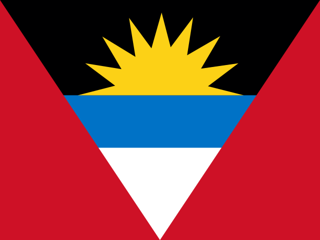
Antigua and Barbuda Flag
Antigua and Barbuda Armorial

Easy learning about Antigua and Barbuda
The capital city of Antigua and Barbuda is St. John’s, capital city of Antigua and Barbuda.
Word: Regatta
Meaning: sailing festival
Administrative Divisions
6 parishes and 2 dependencies.
Parishes:
- Saint George
- Saint John
- Saint Mary
- Saint Paul
- Saint Peter
- Saint Philip
Dependencies:
- Barbuda
- Redonda
Parishes and dependencies of Antigua and Barbuda map
Antigua and Barbuda is a Country of Leeward Islands on the Latin America and the Caribbean located in the Caribbean sub-region in the continent of Americas, member of CARICOM.
07.5 km (4.7 mi)15 km (9.3 mi)22.5 km (14 mi)30 km (19 mi)
Height
0 m (0 ft), 15 m (49 ft), 40 m (131 ft), 75 m (246 ft), 100 m (328 ft), 150 m (492 ft), 250 m (820 ft), 300 m (984 ft), Max altitude 390 m (1280 ft)Sea depth
0 m (0 ft), 150 m (492 ft), 600 m (1970 ft), 1800 m (5910 ft), 3200 m (10500 ft), deeper than 5200 m (17060 ft)Height from west to east in Antigua and Barbuda
Height from south to north in Antigua and Barbuda
1Caribbean Sea0 m
Population of Antigua and Barbuda, 1960–2025
The World Bank: Population, total (SP.POP.TOTL): United Nations Population Division, national statistical offices
Natural Earth · © OpenStreetMap contributors (ODbL) · GEBCO 2026 Grid · Heights: NASADEM, NASA
Basic Information
Capital City: St. John’s, capital city of Antigua and Barbuda
Population: 94,209 (World Bank)
Area: 440 km² / 170 sq mi
People from Antigua and Barbuda are called: Antiguans, Barbudans
Geography
Latitude: 17.076° N
Longitude: 61.807° W
Geographical Subregion: Caribbean
Intermediary Region: Latin America and the Caribbean
Continental Region: Americas
Highest Elevation Point: Mount Obama (402 m)
Lowest point: Caribbean Sea (0 m)
Climate
tropical maritime; little seasonal temperature variation
Human Development
HDI Rank: 53 (UNDP)
HDI Value: 0.851
Mean Years of Schooling: 11.6
Expected Years of Schooling: 15.5
Life Expectancy at Birth: 77.6 Years
Religion
Most Predominant: Protestant Anglican, Seventh Day Adventist, Pentecostal, Moravian, Methodist, Wesleyan Holiness, Church of God, Baptist
Second Most Predominant: Catholic
LGBTI Rights
Legal Status: Legal (ILGA)
Legal Mechanism: Judicial
Death Penalty: No
Maximum Prison Sentence: No
Physical Punishment: No
International Memberships
CARICOM - since 1974
Technical Information
Time Zone: UTC−04:00
Official website: ab.gov.ag
TLD: .ag
Calling Code: +-267
MapGeo Name: Antigua and Barbuda
MapGeo Code: AG