Cape Verde is an Atlantic archipelago that had no people before Portuguese ships arrived in 1456. Morna, the music Cesária Évora carried worldwide, was born on these islands.

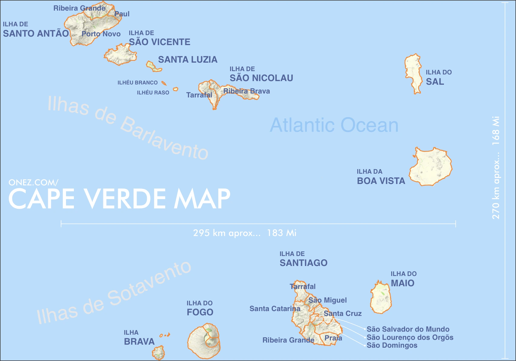

Cape Verde
Cape Verde is an Atlantic archipelago that had no people before Portuguese ships arrived in 1456. Morna, the music Cesária Évora carried worldwide, was born on these islands.

The capital city of Cabo Verde is Praia, capital city of Cabo Verde.
Word: Morna
Meaning: soulful music
22 divisions:
Cape Verde is a Country on the Sub-Saharan Africa located in the Western Africa sub-region in the continent of Africa.
Natural Earth · © OpenStreetMap contributors (ODbL) · GEBCO 2026 Grid · Heights: NASADEM, NASA
Capital City: Praia, capital city of Cabo Verde
Population: 527,326 (World Bank)
Area: 4,033 km² / 2,506 sq mi
People from Cape Verde are called: Cabo Verdeans
Latitude: 15.075° N
Longitude: 23.639° W
Geographical Subregion: Western Africa
Intermediary Region: Sub-Saharan Africa
Continental Region: Africa
Highest Elevation Point: Pico do Fogo (2 829 m)
Lowest point: Pedra de Lume salt ponds (−30 m)
Country Exonyms: Cape Verde
temperate; warm, dry summer; precipitation meager and erratic
EF EPI Position: 89 (EF EPI)
EF EPI Score: 456 (EF EPI)
EF EPI Proficiency: Low Proficiency (EF EPI)
HDI Rank: 135 (UNDP)
HDI Value: 0.668
Mean Years of Schooling: 6.1
Expected Years of Schooling: 11.4
Life Expectancy at Birth: 76.1 Years
Most Predominant: Catholic
Second Most Predominant: Protestant includes Church of the Nazarene, Adventist, Assembly of God, Universal Kingdom of God, and God and Love
Legal Status: Legal (ILGA)
Legal Mechanism: Legislative
Death Penalty: No
Maximum Prison Sentence: No
Physical Punishment: No
Time Zone: UTC−01:00
Official website: governo.cv
TLD: .cv
Calling Code: +238
MapGeo Name: Cape Verde
MapGeo Code: CV