Indonesia is an Southeast-Asian archipelago accelerating its digital economy, holding major nickel reserves for batteries, and expanding maritime infrastructure.

Indonesia
Indonesia is an Southeast-Asian archipelago accelerating its digital economy, holding major nickel reserves for batteries, and expanding maritime infrastructure.


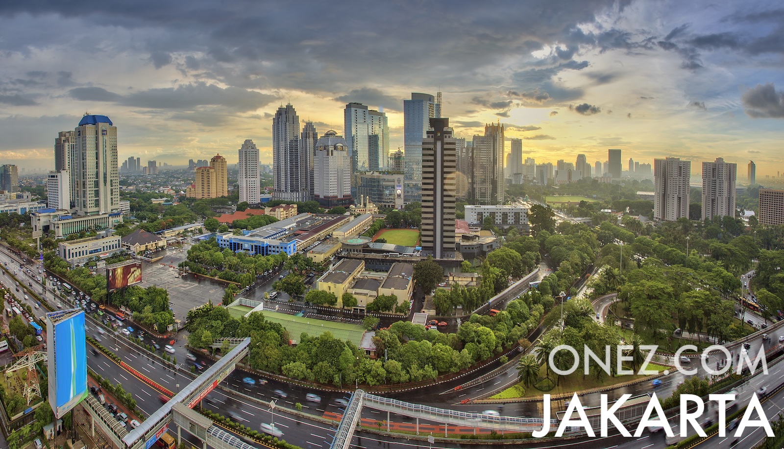
The capital city of Indonesia is Jakarta, capital city of Indonesia.
Word: Batik
Meaning: wax print
35 provinces (provinsi-provinsi),
Indonesia is a Country located in the South-eastern Asia sub-region in the continent of Asia.
Capital City: Jakarta, capital city of Indonesia
Population: 285,721,236 (UN)
Area: 1,919,440 km² / 1,192,682 sq mi
People from Indonesia are called: Indonesians
Latitude: 0.954° S
Longitude: 101.893° E
Geographical Subregion: South Eastern Asia
Continental Region: Asia
tropical; hot, humid; more moderate in highlands
EF EPI Position: 80 (EF EPI)
EF EPI Score: 468 (EF EPI)
EF EPI Proficiency: Low Proficiency (EF EPI)
Global Peace Index Rank: 69 (GPI)
Global Peace Index Score: 1.918 (GPI)
HDI Rank: 113 (UNDP)
HDI Value: 0.728
Mean Years of Schooling: 8.7
Expected Years of Schooling: 13.3
Life Expectancy at Birth: 71.1 Years
Most Predominant: Muslim
Second Most Predominant: Protestant
Legal Status: Illegal (ILGA)
Legal Mechanism: N/A
Death Penalty: No
Maximum Prison Sentence: No
Physical Punishment: No
TLD: .id
Calling Code: +62
MapGeo Name: Indonesia
MapGeo Code: ID
