
De Democratische Republiek Congo is een Centraal-Afrikaanse natie die beschikt over 70% van het wereldwijde kobalt, aanzienlijk koper- en waterkrachtpotentieel bij de Inga-watervallen, het uitgestrekte koolstofreservoir van het Congoregenwoud en regionale digitale corridorprojecten.
Democratische Republiek Congo
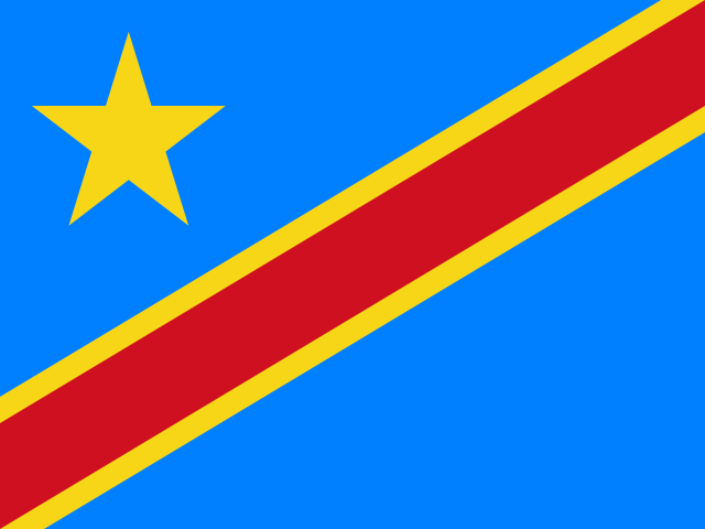
Democratic Republic of the Congo Vlag
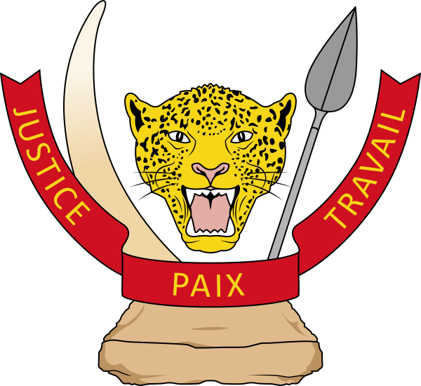
Democratic Republic of the Congo Wapen
Leer gemakkelijk over Democratic Republic of the Congo
De hoofdstad van Democratic Republic of the Congo is Kinshasa, hoofdstad van de Democratische Republiek Congo.
Woord: Cobalt
Betekenis: vital mineral
Bestuurlijke indeling
25 provinces and 1 city.
Provinces:
- Bas-Uele
- Équateur
- Haut-Katanga
- Haut-Lomami
- Haut-Uele
- Ituri
- Kasaï District
- Kasai-Oriental
- Kongo Central
- Kwango
- Kwilu
- Lomami
- Lualaba
- Lulua District
- Mai-Ndombe
- Maniema
- Mongala
- North Kivu
- North Ubangi
- Sankuru
- South Kivu
- South Ubangi
- Tanganyika
- Tshopo
- Tshuapa
City:
- Kinshasa
Provincies en stad van Democratische Republiek Congo kaart
Democratische Republiek Congo is een Land op de Sub-Saharan Africa gelegen in de subregio Central Africa op het continent Africa.
0600 km (373 mi)1200 km (746 mi)1800 km (1118 mi)2400 km (1491 mi)
Hoogte
0 m (0 ft), 400 m (1310 ft), 500 m (1640 ft), 700 m (2300 ft), 900 m (2950 ft), 1200 m (3940 ft), 1600 m (5250 ft), 1900 m (6230 ft), 2100 m (6890 ft), Maximale hoogte 4758 m (15610 ft)Zeediepte
0 m (0 ft), 150 m (492 ft), 600 m (1970 ft), 1800 m (5910 ft), 3200 m (10500 ft), dieper dan 5200 m (17060 ft)Hoogte van west naar oost in Democratische Republiek Congo
Hoogte van zuid naar noord in Democratische Republiek Congo
1Congo152 tot 563 m2Lomami371 tot 1 068 m3Lualaba364 tot 1 396 m
Bevolking van Democratische Republiek Congo, 1960–2025
The World Bank: Population, total (SP.POP.TOTL): United Nations Population Division, national statistical offices
Basisinformatie
Hoofdstad: Kinshasa, hoofdstad van de Democratische Republiek Congo
Bevolking: 112,832,473 (World Bank)
Oppervlakte: 2,344,858 km² / 905,354 sq mi
Inwoners van Democratische Republiek Congo heten: Congolese
Geografie
Breedtegraad: 1.858° S
Lengtegraad: 23.459° E
Geografische subregio: Centraal-Afrika (Midden-Afrika)
Intermediaire regio: Sub-Sahara Afrika
Continentale regio: Afrika
Hoogste punt: Mount Stanley (5 109 m)
Lowest point: Atlantic Ocean (0 m)
Grenzen
- Tanzania — Landgrens
- Centraal-Afrikaanse Republiek — Landgrens
- Zuid-Soedan — Landgrens
- Rwanda — Landgrens
- Zambia — Landgrens
- Burundi — Landgrens
- Angola — Landgrens
Klimaat
tropical; hot and humid in equatorial river basin; cooler and drier in southern highlands; cooler and wetter in eastern highlands; north of Equator - wet season (April to October), dry season (December to February); south of Equator - wet season (November to March), dry season (April to October)
Menselijke ontwikkeling
HDI rang: 171 (UNDP)
HDI waarde: 0.522
Gemiddelde schooljaren: 7.4
Verwachte schooljaren: 10.9
Levensverwachting bij geboorte: 61.9 Jaar
Religie
Meest voorkomende religie: Katholiek and Propestant
Op één na meest voorkomende religie: Ander
LGBTI-rechten
Juridische status: Legaal (ILGA)
Juridisch mechanisme: N/A
Doodstraf: No
Maximale gevangenisstraf: No
Lichamelijke straf: No
Technische informatie
Tijdzone: UTC+01:00, UTC+02:00
TLD: .cd
Landnummer: +243
MapGeo naam: Democratic Republic of Congo
MapGeo code: CD