
Republik Dominika
Dominican Republic Bendera

Dominican Republic Lambang

Dominican Republic is a Hispaniola nation with the Caribbean’s largest economy, diversified tourism, thriving free-trade zones for electronics and apparel, and a 25 % renewable-energy target by 2025.
Dominican Republic adalah sebuah Negara di Latin America and the Caribbean terletak di Caribbean sub-wilayah Americas benua.
Belajar mudah tentang Dominican Republic
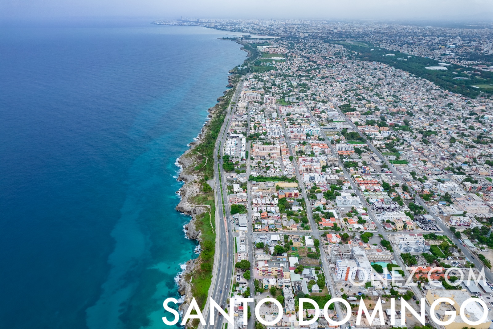
Ibu kota Dominican Republic adalah Santo Domingo.
Kata: Merengue
Arti: dance beat
Yang Membedakan Tempat Ini
<p>The Dominican Republic packs many special things into a small space. Santo Domingo’s Colonial Zone is the first European city in the Americas. Pico Duarte is the highest mountain in the Caribbean, and hikers can reach its top. The country has two very different coasts: calm Caribbean beaches in the south and surfing beaches on the Atlantic in the north. At the 27 Waterfalls of Damajagua people climb rocks and jump into clear pools. From January to March humpback whales swim close to shore in Samaná Bay. Lake Enriquillo lies below sea level and is home to crocodiles and flamingos. Merengue and bachata music started here, and baseball is so popular that the nation sends many players to the Major Leagues.</p>
Informasi Dasar
Ibu Kota: Santo Domingo
Penduduk: 11,331,265 (UN)
Luas Wilayah: 48,730 km² / 30,279 sq mi
Penduduk disebut: Dominicans
Jenis: Negara
Pembagian Administratif
31 provinces (provincias),
- Azua,
- Baoruco,
- Barahona,
- Dajabón,
- Distrito Nacional*,
- Duarte,
- Elías Piña,
- El Seibo,
- Espaillat,
- Hato Mayor,
- Hermanas Mirabal,
- Independencia,
- La Altagracia,
- La Romana,
- La Vega,
- María Trinidad Sánchez,
- Monseñor Nouel,
- Monte Cristi,
- Monte Plata,
- Pedernales,
- Peravia,
- Puerto Plata,
- Samaná,
- Sánchez Ramírez,
- San Cristóbal,
- San José de Ocoa,
- San Juan,
- San Pedro de Macorís,
- Santiago,
- Santiago Rodríguez,
- Santo Domingo,
- Valverde
Geografi
Lintang: 19° 00' N
Bujur: 70° 40' W
Sub-wilayah Geografis: Karibia
Wilayah Perantara: Latin America and the Caribbean
Wilayah Benua: Amerika
Perbatasan
- Haiti — Perbatasan darat
Iklim
tropical maritime; little seasonal temperature variation; seasonal variation in rainfall
Indeks Global
Posisi EF EPI: 60 (EF EPI)
Skor EF EPI: 503 (EF EPI)
Kemahiran EF EPI: Kemampuan sedang (EF EPI)
Peringkat Indeks Perdamaian Global: 97 (GPI)
Skor Indeks Perdamaian Global: 2.157 (GPI)
Pembangunan Manusia
Peringkat IPM: 89 (UNDP)
Nilai IPM: 0.776
Rata-rata Tahun Sekolah: 9,4
Harapan Tahun Sekolah: 13,6
Harapan Hidup saat Lahir: 73,7 Tahun
Agama
Agama Mayoritas: Katolik
Agama Mayoritas Kedua: Evangelis
Informasi Teknis
TLD: .do
Kode Telepon: +1-809 and 1-829
Nama MapGeo: Dominican Republic
Kode MapGeo: DO