
Kiribati ist eine pazifische Republik, die eines der weltweit größten Meeresschutzgebiete verwaltet, grüne Staatsanleihen ausgibt und auf ihren Atollen solare Mikronetze einführt.
Kiribati
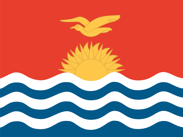
Kiribati Flagge
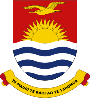
Kiribati Wappen
Einfach lernen über Kiribati
Die Hauptstadt von Kiribati ist Tarawa, Hauptstadt von Kiribati.
Wort: Atoll
Bedeutung: ring islands
Verwaltungsgliederung
3 geographical units/: Gilbert Islands, Line Islands, Phoenix Islands
- note - there are no first-order administrative divisions, but there are 6 districts
- (Banaba
- Central Gilberts
- Line Islands
- Northern Gilberts
- Southern Gilberts
- Tarawa) and 21 island councils - one for each of the inhabited islands
- (Abaiang
- Abemama
- Aranuka
- Arorae
- Banaba
- Beru
- Butaritari
- Kanton
- Kiritimati
- Kuria
- Maiana
- Makin
- Marakei
- Nikunau
- Nonouti
- Onotoa
- Tabiteuea
- Tabuaeran
- Tamana
- Tarawa
- Teraina)
Verwaltungseinheiten von Kiribati Karte
Kiribati ist ein Land in der Subregion Micronesia gelegen auf dem Kontinent Oceania.
015 km (9.3 mi)30 km (19 mi)45 km (28 mi)60 km (37 mi)
Höhe
-3 m (-10 ft), 5 m (16 ft), 10 m (33 ft), 25 m (82 ft), Maximale Höhe 34 m (112 ft)Meerestiefe
0 m (0 ft), 150 m (492 ft), 600 m (1970 ft), 1800 m (5910 ft), 3200 m (10500 ft), tiefer als 5200 m (17060 ft)Höhe von Westen nach Osten in Kiribati
Höhe von Süden nach Norden in Kiribati
1Nordpazifik0 m
Bevölkerung von Kiribati, 1960–2025
The World Bank: Population, total (SP.POP.TOTL): United Nations Population Division, national statistical offices
Natural Earth · © OpenStreetMap contributors (ODbL) · GEBCO 2026 Grid · Heights: NASADEM, NASA
Grundlegende Informationen
Hauptstadt: Tarawa, Hauptstadt von Kiribati
Bevölkerung: 136,488 (World Bank)
Fläche: 811 km² / 504 sq mi
Menschen aus Kiribati heißen: I-Kiribati
Geographie
Breitengrad: 1.820° N
Längengrad: 157.385° W
Geografische Teilregion: Mikronesien
Kontinentale Region: Ozeanien
Höchster Punkt: Banaba Island (81 m)
Lowest point: Pacific Ocean (0 m)
Klima
tropical; marine, hot and humid, moderated by trade winds
Menschliche Entwicklung
HDI Rang: 140 (UNDP)
HDI Wert: 0.644
Durchschnittliche Schuljahre: 9.1
Erwartete Schuljahre: 11.9
Lebenserwartung bei Geburt: 66.5 Jahre
Religion
Vorherrschende Religion: Katholisch
Zweithäufigste Religion: Kongregationalistisch
LGBTI-Rechte
Rechtsstatus: Illegal (ILGA)
Rechtlicher Mechanismus: N/A
Todesstrafe: No
Maximale Gefängnisstrafe: 14 Jahre
Körperstrafe: No
Technische Informationen
Zeitzone: UTC+12:00, UTC+13:00, UTC+14:00
Offizielle Website: kiribati.gov.ki
TLD: .ki
Vorwahl: +686
MapGeo Name: Kiribati
MapGeo Code: KI