Kazakhstan is a Central-Asian republic rich in oil, uranium, and rare-earth minerals, expanding Belt-and-Road logistics, and developing large onshore wind projects.

Kazakhstan
Kazakhstan is a Central-Asian republic rich in oil, uranium, and rare-earth minerals, expanding Belt-and-Road logistics, and developing large onshore wind projects.


Kazakhstan is a Country located in the Central Asia sub-region of the Asia continent, member of CSTO - Collective Security Treaty Organization.
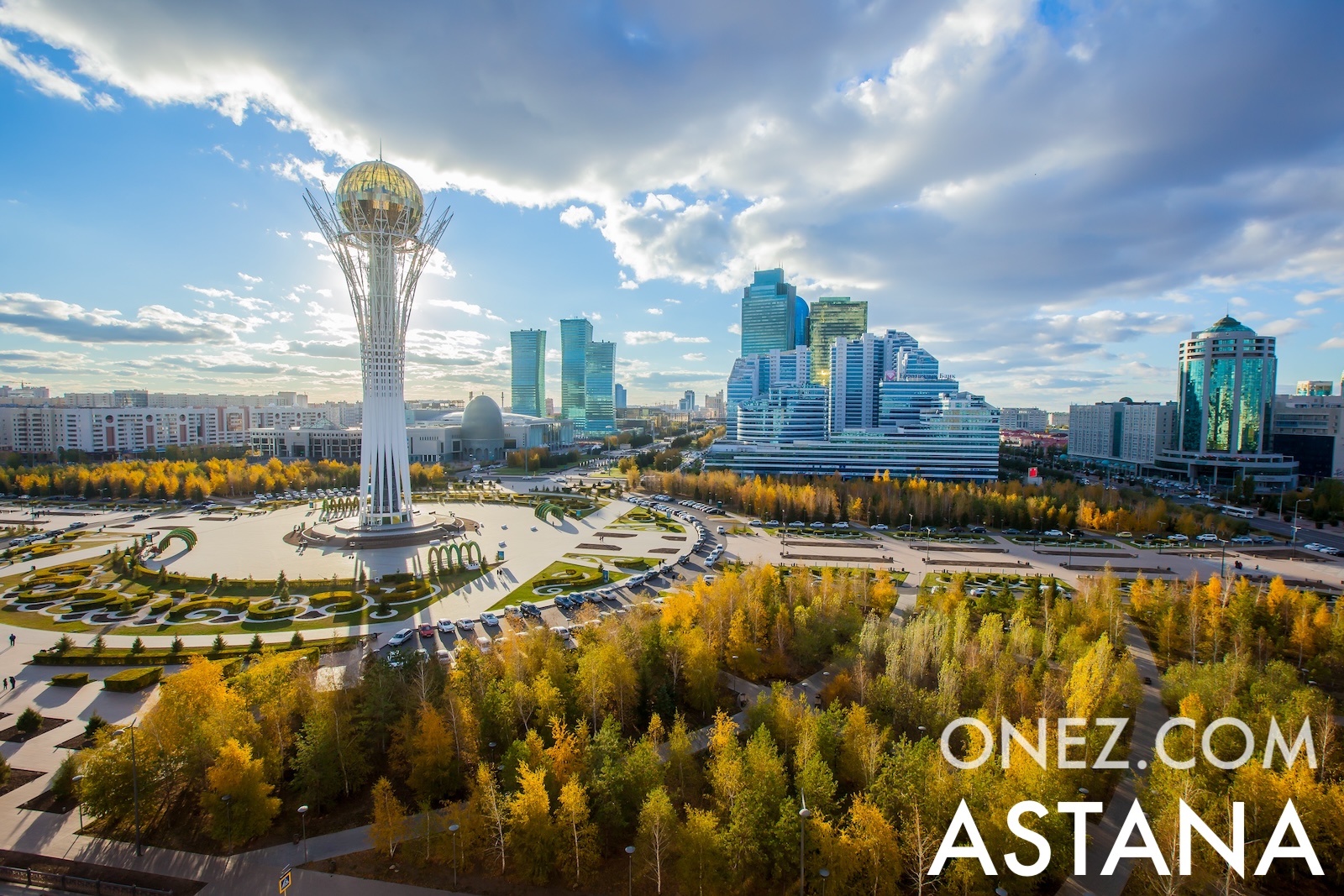
The capital city of Kazakhstan is Astana (In 2019, the city briefly adopted the name Nur-Sultan in honor of former president Nursultan Nazarbayev, but it returned to the name Astana in 2022).
Word: Steppe
Meaning: vast grasslands
Population: 20,843,754 (UN)
Area: 2,717,300 km² / 1,688,449 sq mi
People are called: Kazakhstanis, Kazakhs
Type: Country
17 provinces (oblystar) and 4 cities* (qalalar)
Latitude: 48° 00' N
Longitude: 68° 00' E
Geographical Subregion: Central Asia
Continental Region: Asia
continental, cold winters and hot summers, arid and semiarid
EF EPI Position: 103 (EF EPI)
EF EPI Score: 427 (EF EPI)
EF EPI Proficiency: Very Low Proficiency (EF EPI)
Global Peace Index Rank: 44 (GPI)
Global Peace Index Score: 1.771 (GPI)
HDI Rank: 60 (UNDP)
HDI Value: 0.837
Mean Years of Schooling: 12.5
Expected Years of Schooling: 14.0
Life Expectancy at Birth: 74.4 Years
Most Predominant: Muslim
Second Most Predominant: Christian mainly Russian Orthodox
Legal Status: Legal (ILGA)
Legal Mechanism: Legislative
Death Penalty: No
Maximum Prison Sentence: No
Physical Punishment: No
CSTO - Collective Security Treaty Organization
OPEC+
TLD: .kz
Calling Code: +7
MapGeo Name: Kazakhstan
MapGeo Code: KZ